Details
Lines, editing, arriving, files, empty states, Settings, layers and map controls.
The everyday parts: lines, editing, arriving, files, empty and error states, Settings and layers. Same rules as the Features: what it is, what changes from Land Nav 1, and what is still to decide.
- Tracks, routes and areas
- Editing a marker
- Arriving
- Import and export
- Project From Here
- Empty and error states
- Settings pages
- Layers
- Map controls
Tracks, routes and areas
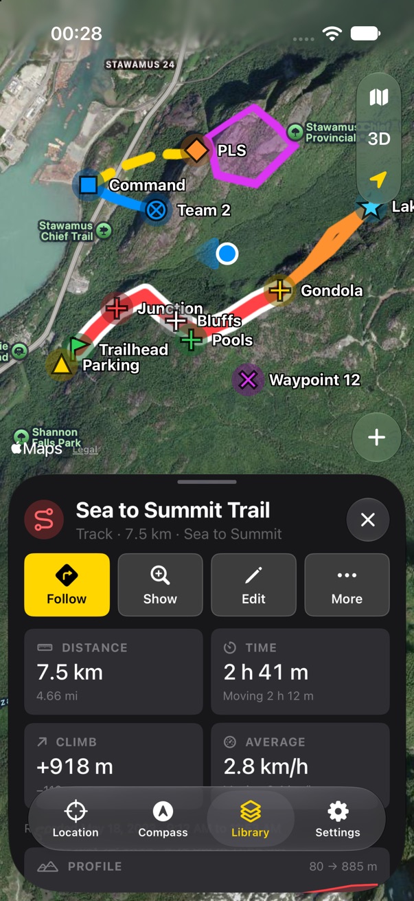
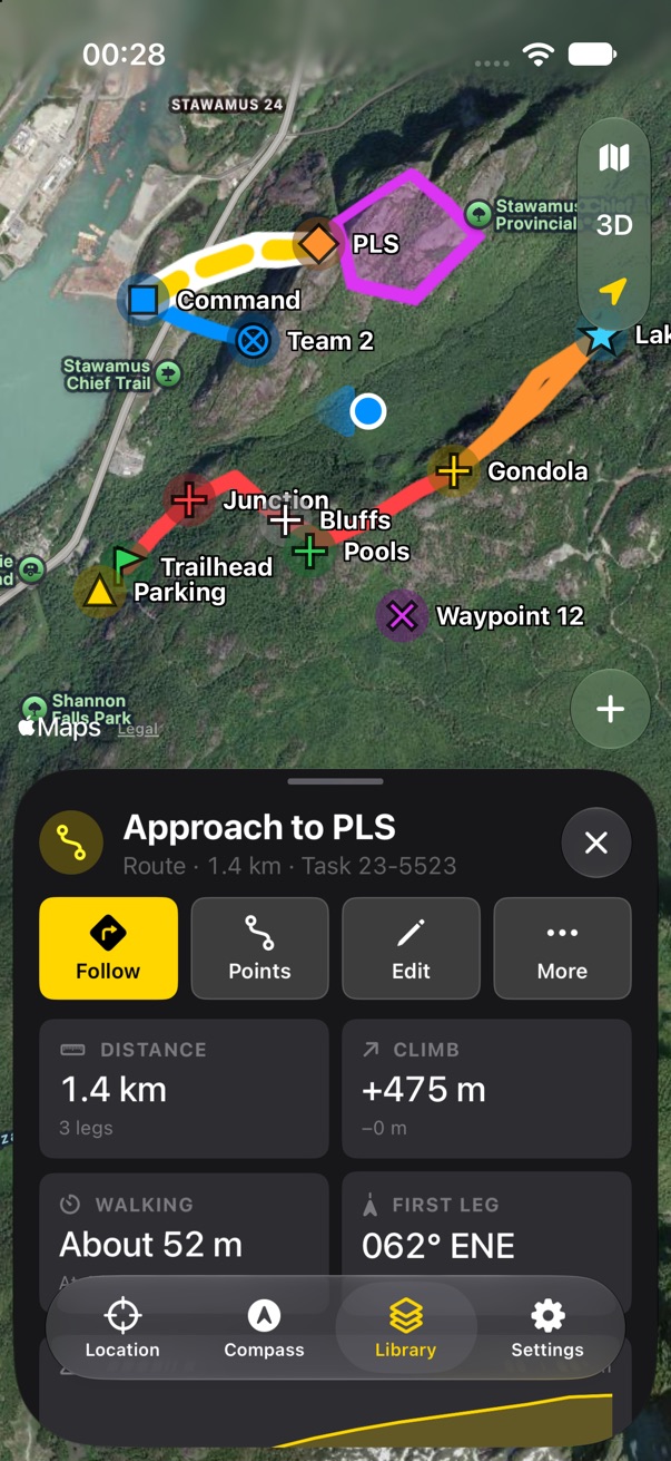
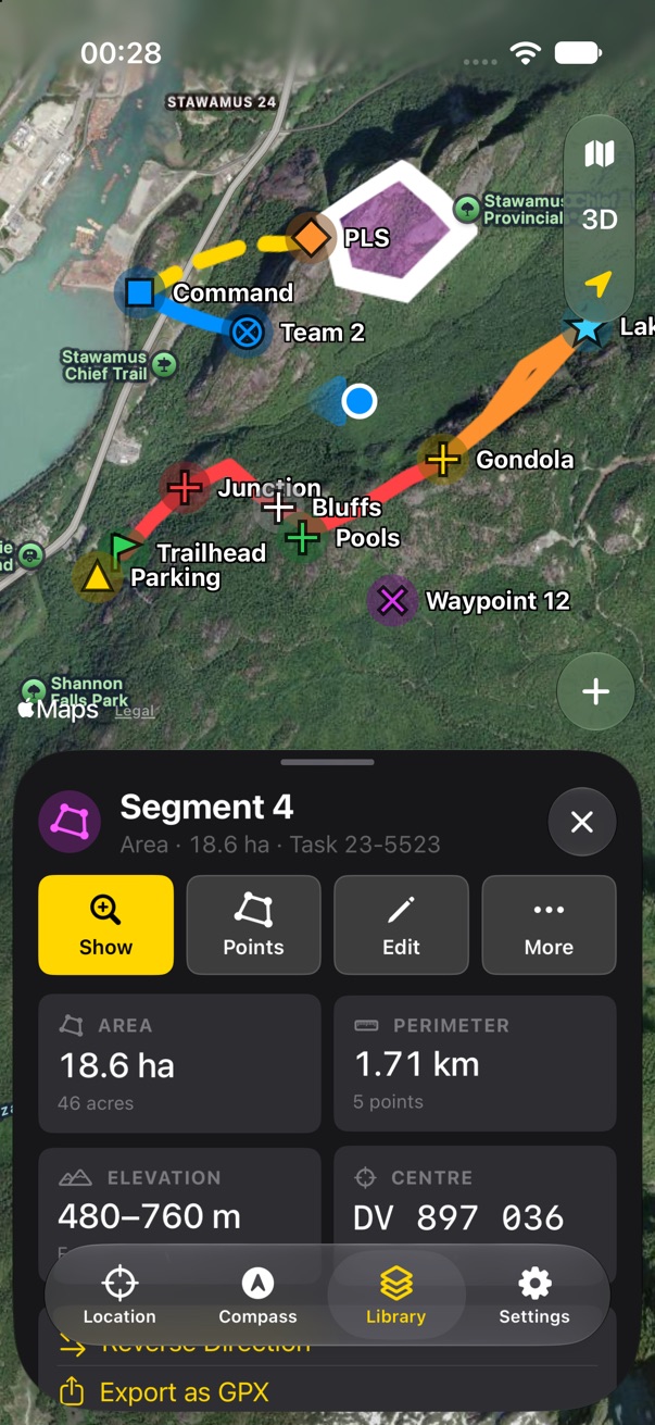
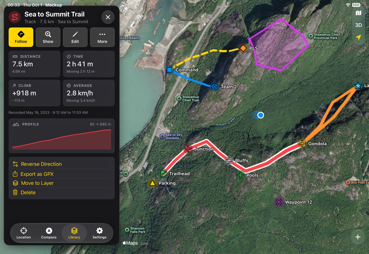
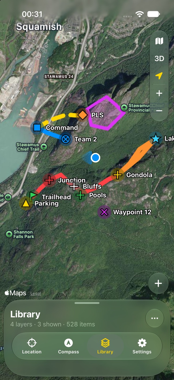
A line gets the same panel a marker does, with its own numbers. A track is what you walked: distance, time and moving time, climb, average speed, and a profile. A route is what you plan to walk: distance, climb, a walking time from distance and climb, and the first leg's bearing. An area gets its size, perimeter, height range and centre. On the map, routes are dashed and areas are filled, so the three never look alike; the selected one gets a white edge, as a selected marker gets a white ring.
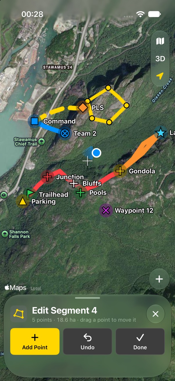
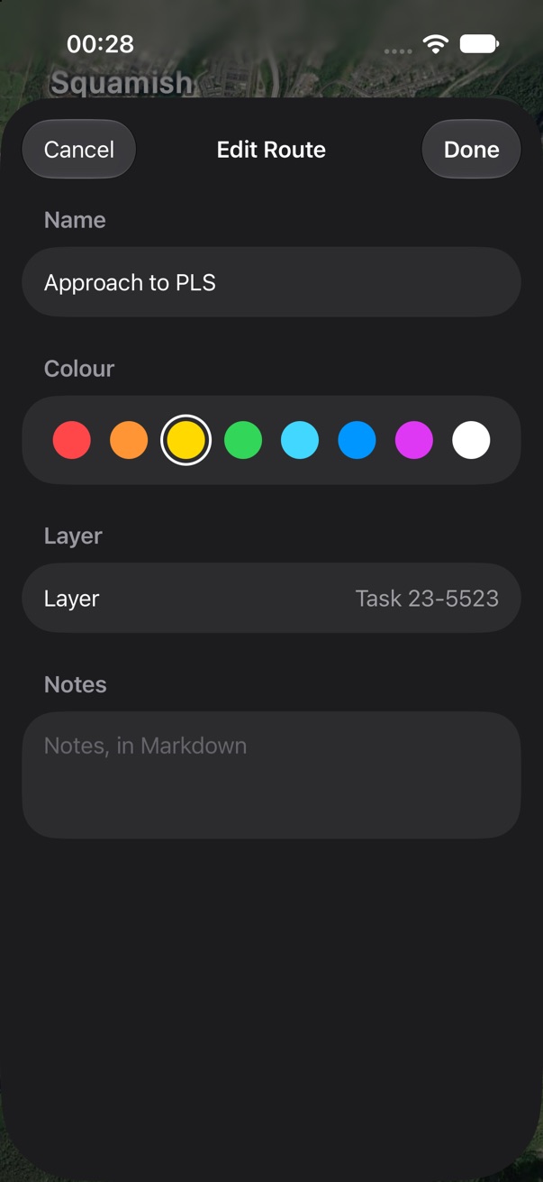
Points opens the drawing panel with the line's points already placed. Edit is a sheet with name, colour, layer and notes. Reverse, Export, Move to Layer and Delete are below the cells.
- Follow on a track or route: navigate to the nearest point, then leg by leg? That is new work in navigation, not just design.
- v1 calls areas regions. Area is plainer. Keep it?
Editing a marker
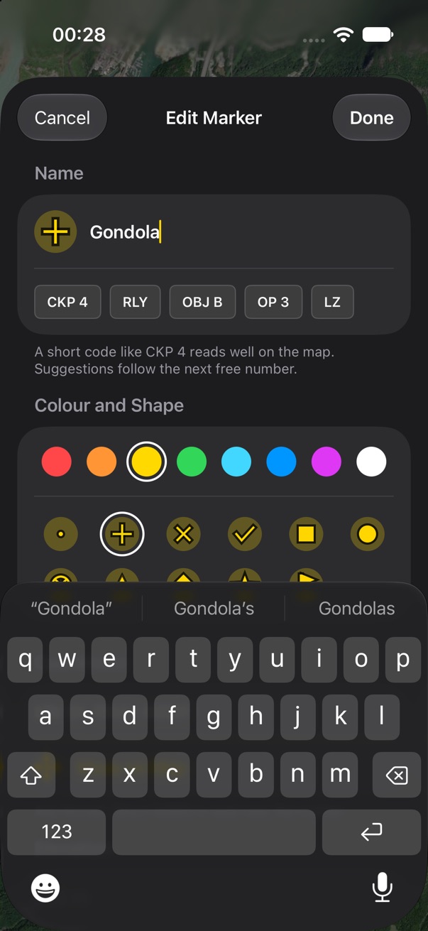
The edit sheet puts the name first, with the marker beside it, so you see what the map will show. Short codes are offered under the field (CKP 4, RLY, OBJ B), each with the next free number. Then colour and shape in one section: eight swatches and the eleven shapes, drawn in the chosen colour. Then the coordinate, typed in any format or set with Move on Map; elevation, from the map unless you type your own; the layer; and notes in Markdown.
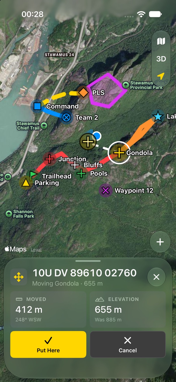
Move on Map is a tool panel. The map moves under a fixed crosshair, so a finger never covers the spot. The marker rides the crosshair, a dashed line goes back to where it was, and the panel shows the new coordinate, how far it moved, and the new elevation. Put Here or Cancel.
- Should code suggestions come from the markers page lists only, or also learn from your own names?
Arriving
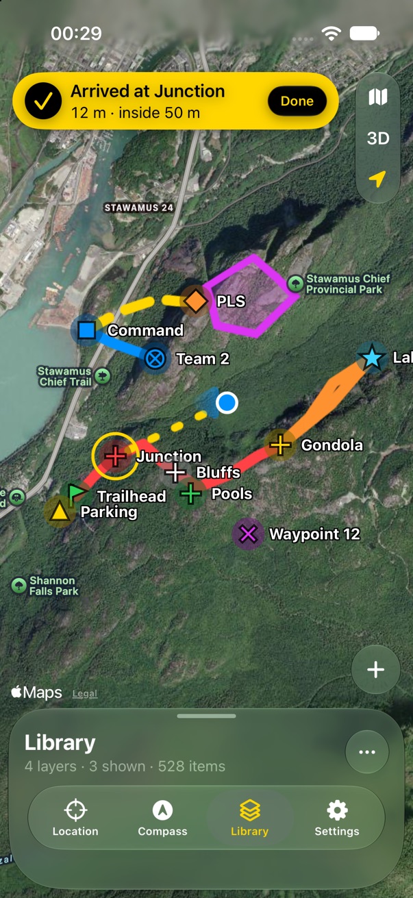
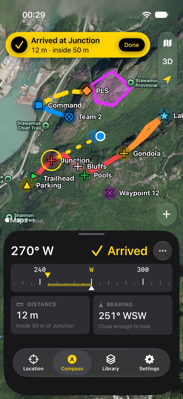
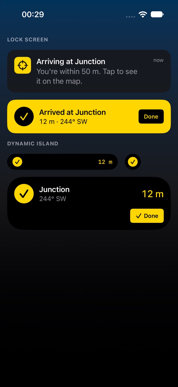
Inside the arrival distance, the banner turns solid yellow and says Arrived, with the distance left and the radius. Stop becomes Done: you got there, nothing went wrong. The compass header says Arrived instead of the turn. The alert fires once, with a haptic, even with the screen locked, as in v1; the Live Activity turns yellow with Done. Nothing ends on its own: GPS wanders, so leaving the radius and coming back doesn't fire again.
- End navigation automatically a few minutes after arriving, or always wait for Done?
Import and export
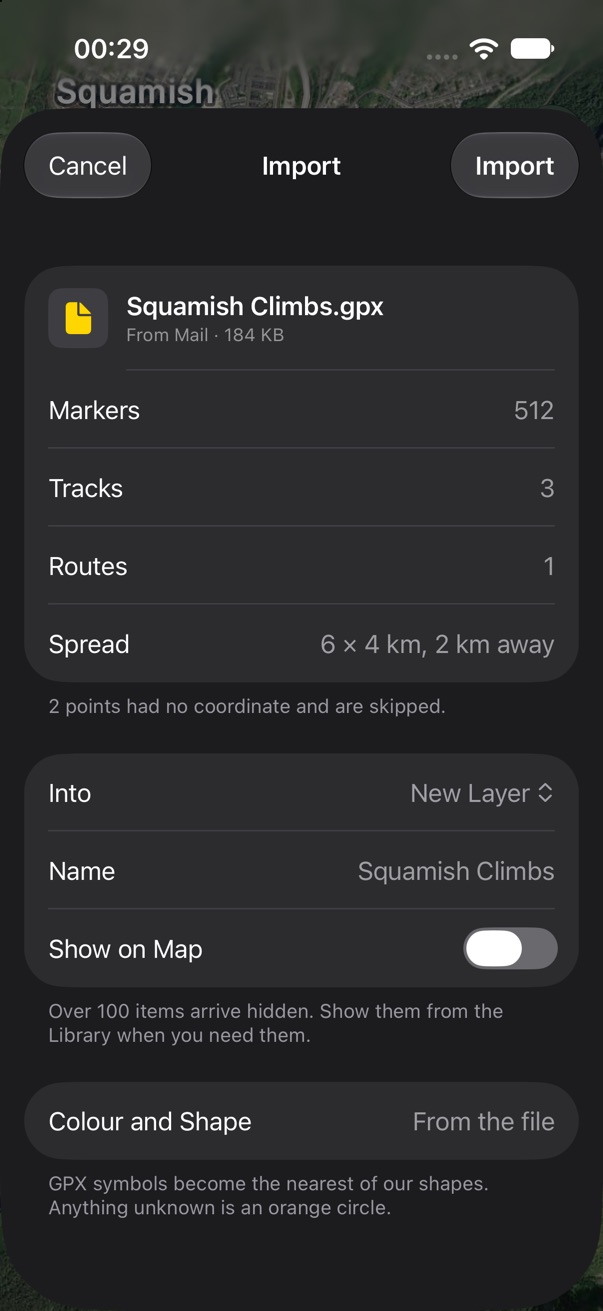
A GPX or ZIP opened from Files, Mail, Safari or AirDrop opens a sheet that says what is in it before anything changes: counts, how spread out it is and how far away, and anything skipped. Safe defaults: a new layer named after the file, and hidden if it has over 100 items, so a big import never buries the map. GPX symbols become the nearest of our shapes.
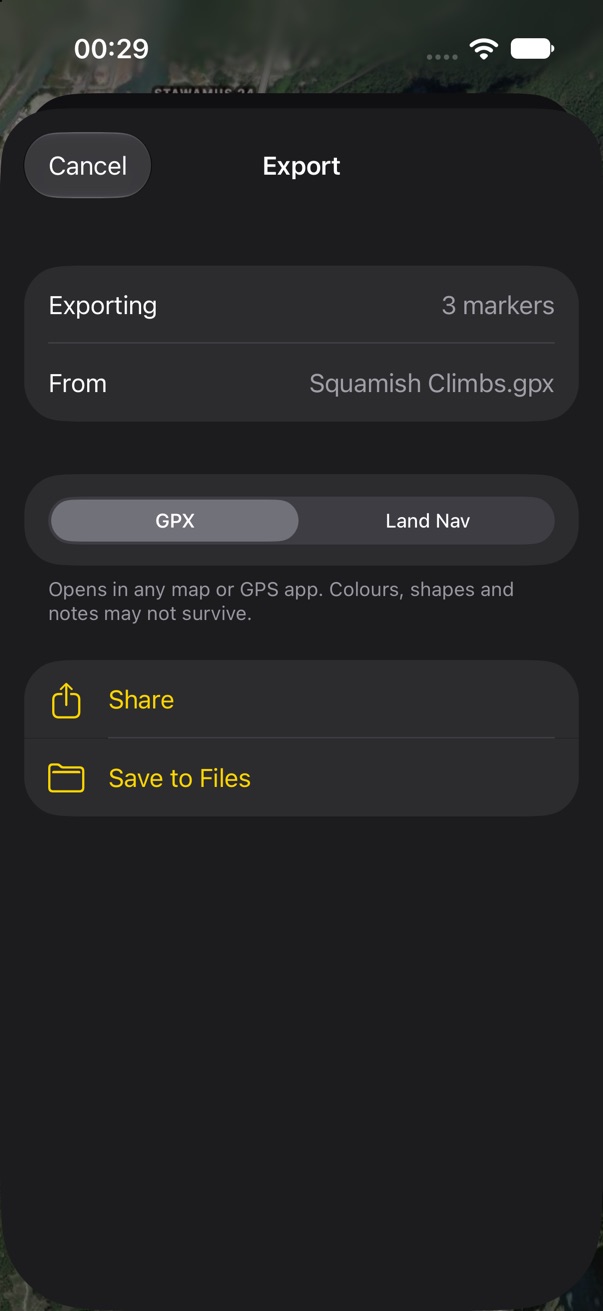
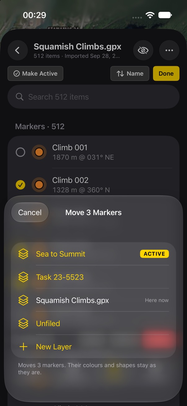
Export comes from a layer's menu, a line's More, or the selection bar. Two formats: GPX for any other app, and a Land Nav file that keeps layers, colours, shapes and notes. Then the share sheet or Save to Files. Move to Layer is a short list: one tap moves and closes.
- Is 100 items the right line for arriving hidden?
- KML or CSV export? v1 had neither; GPX covers most apps.
Project From Here
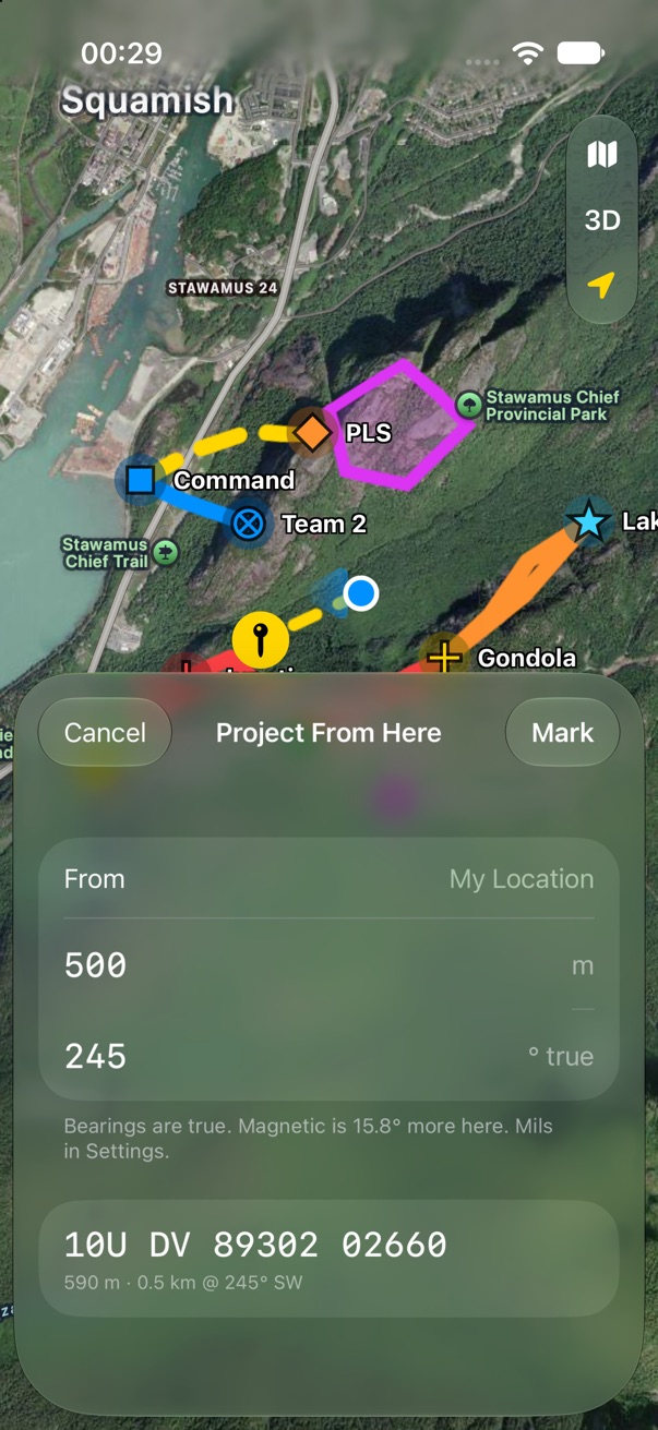
A distance and a bearing from you, or from a marker's More. It is a short sheet, not a full one, so the projected point and its dashed line show on the map above it. The result is a coordinate you can Mark. The footer says which north the bearing is in and how far magnetic is from true here, since this is where people get it wrong.
- True or magnetic by default? A field compass reads magnetic; v1 used the bearing setting.
Empty and error states
Every state says what happened, what still works, and the one thing to do. Loud for what you should fix, quiet for what you can live with:
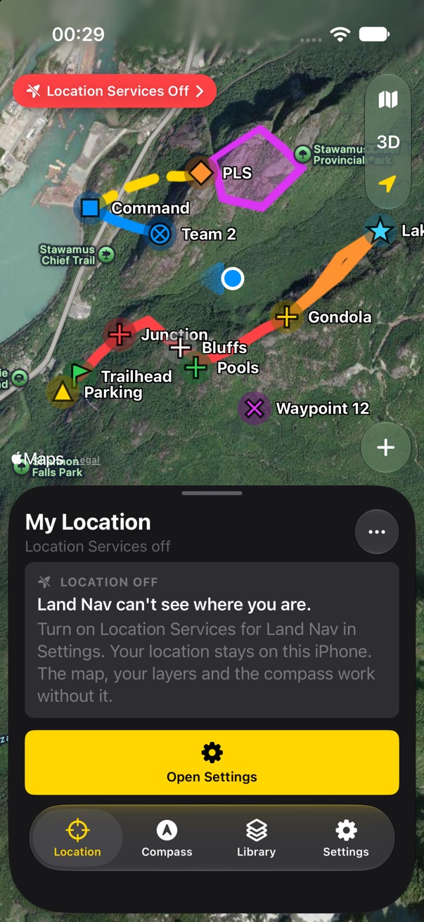
- Location off. A red badge, and the Location tab explains and offers Open Settings. The map, layers and compass still work, and it says so.
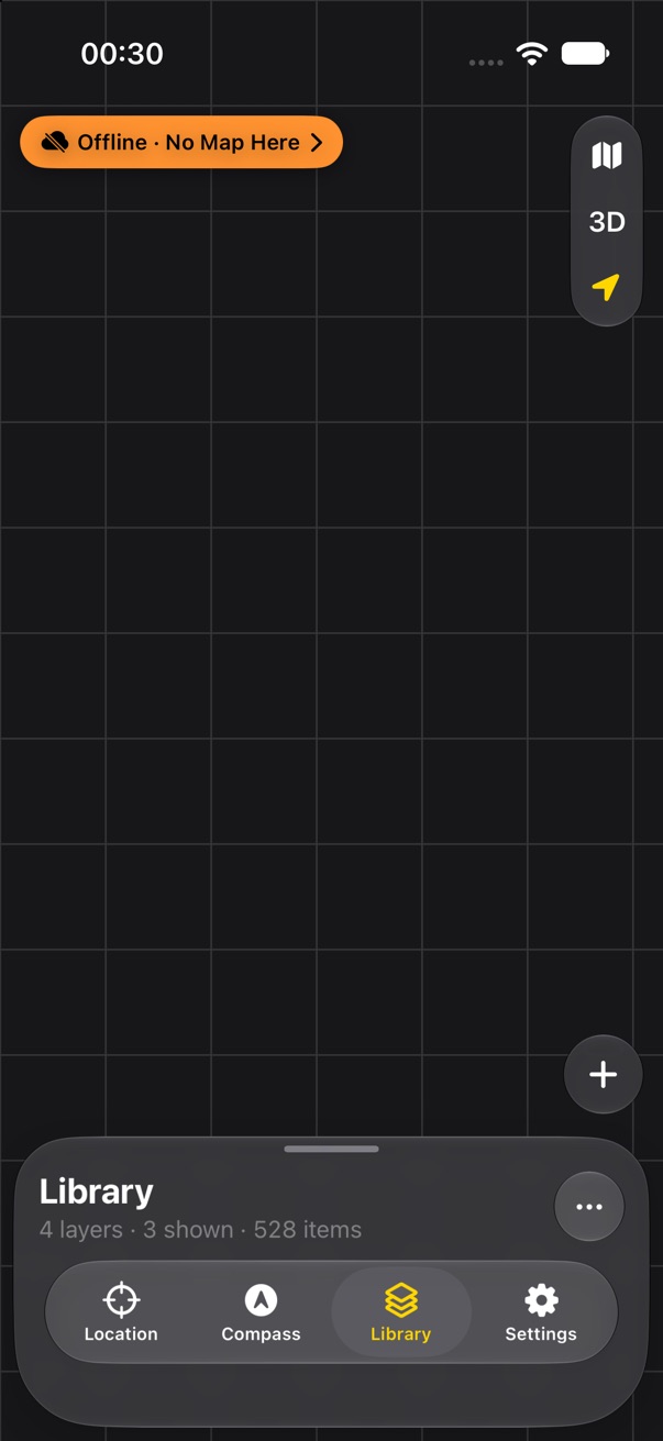
- Offline with no map here. An orange badge. The map is an empty grid; markers and tracks still draw on it. Tapping the badge says how to download an area next time.
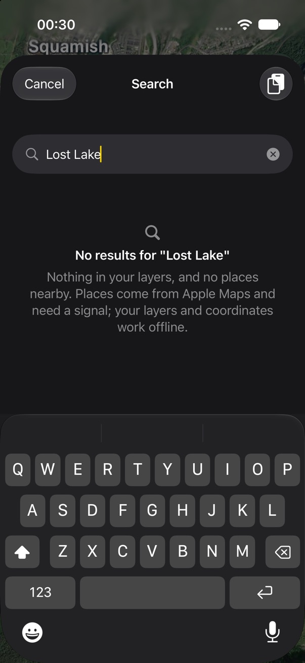
- No search results. Says where it looked, and that places need a signal while your layers and coordinates don't.
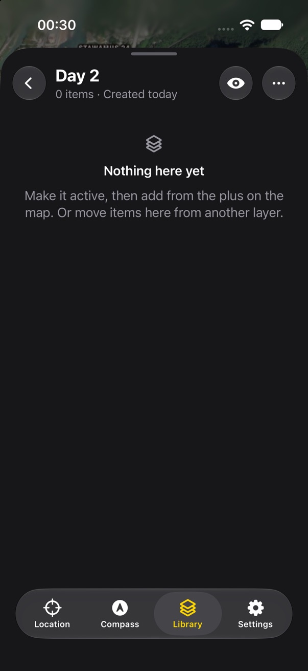
- An empty layer. Says how things get in, since adding is on the map, not in the Library.
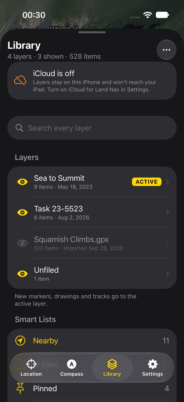
- iCloud off. A row at the top of the Library: layers stay on this iPhone.
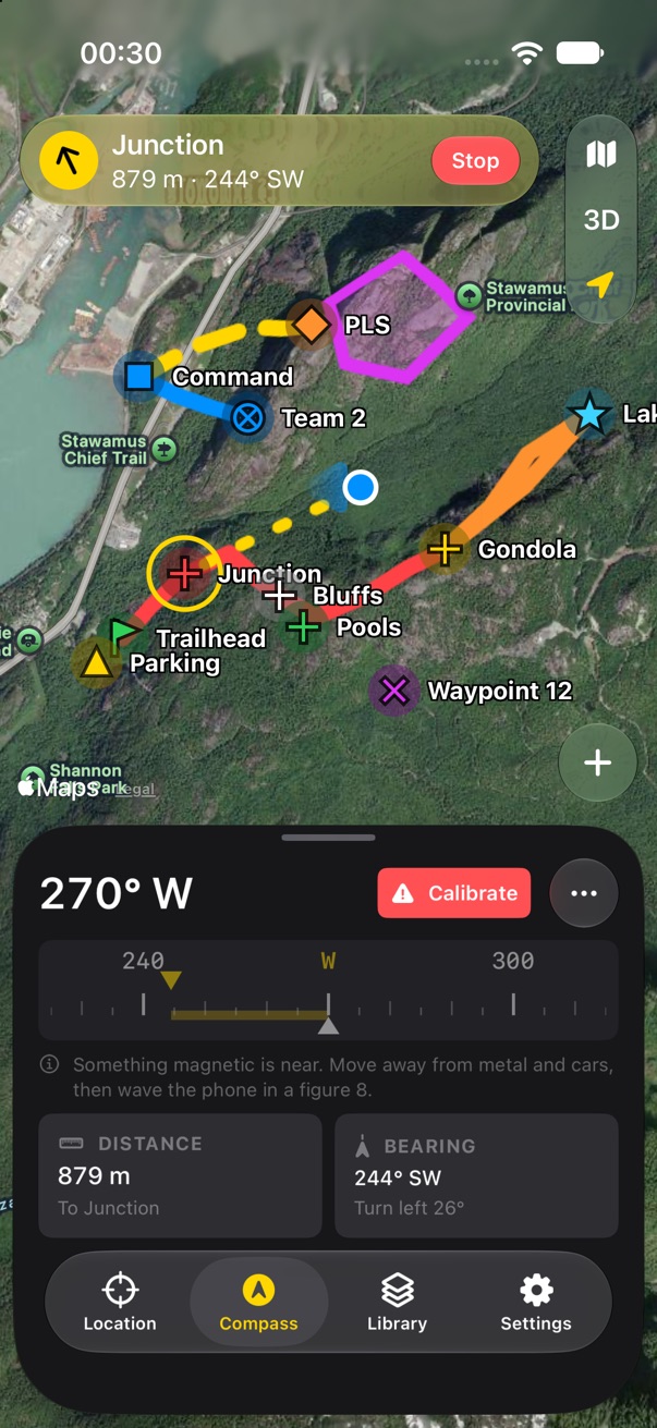
- Compass interference. A red Calibrate tag where the turn would be, the tape dimmed, and how to fix it.
- The offline grid is drawn over the whole mockup map, hiding the markers; Mapbox would draw them on it. Judge the badge, not the grid.
- Reduced accuracy (approximate location) needs its own wording; v1 had a badge for it.
Settings pages
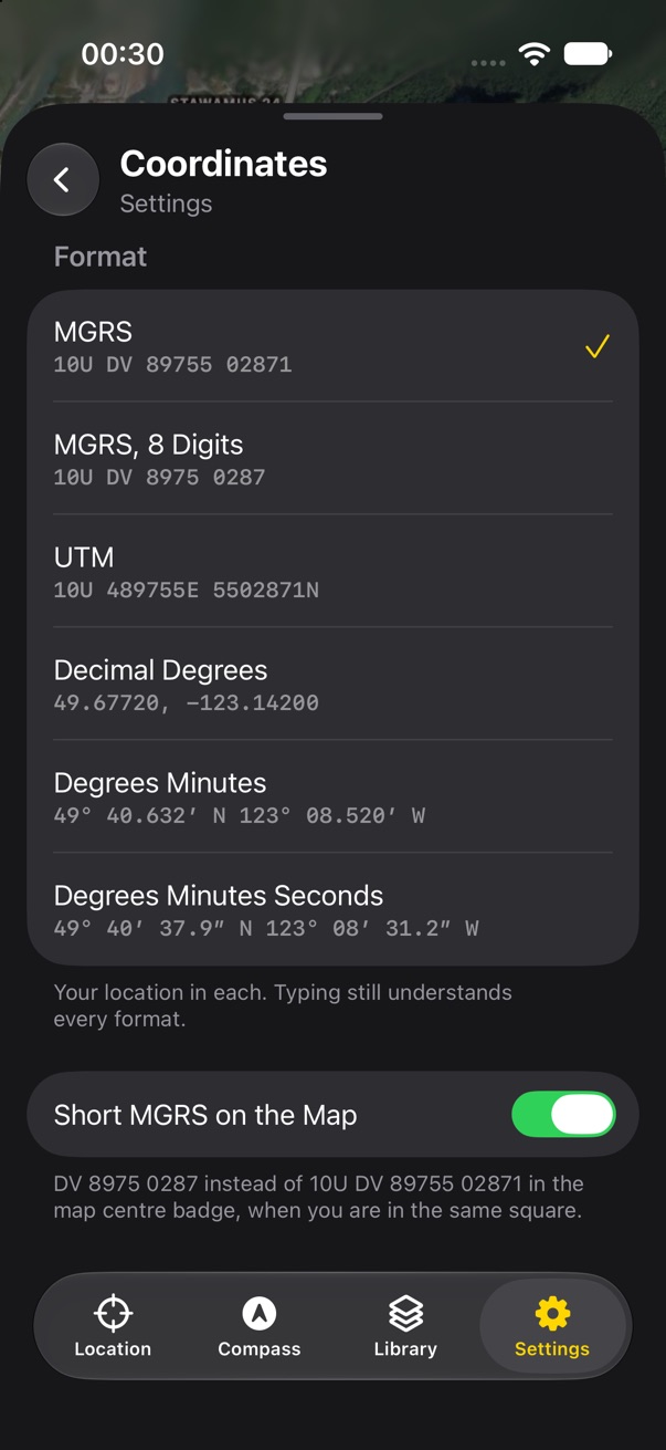
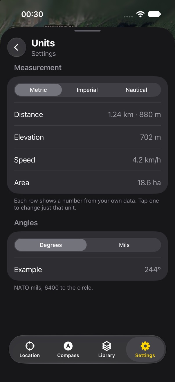
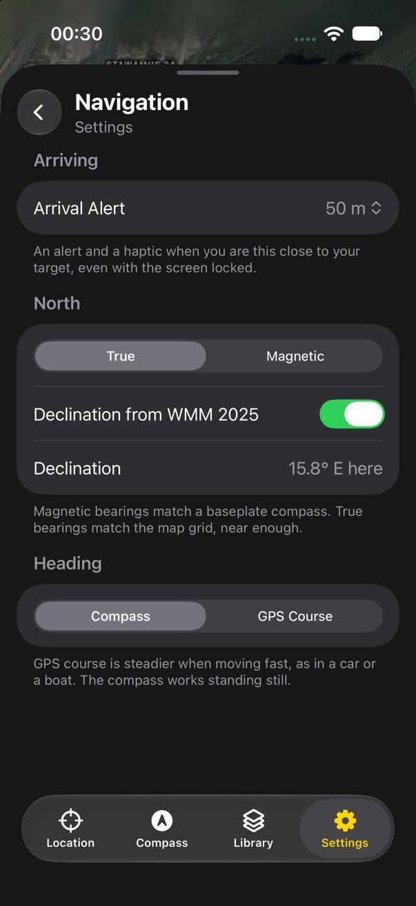
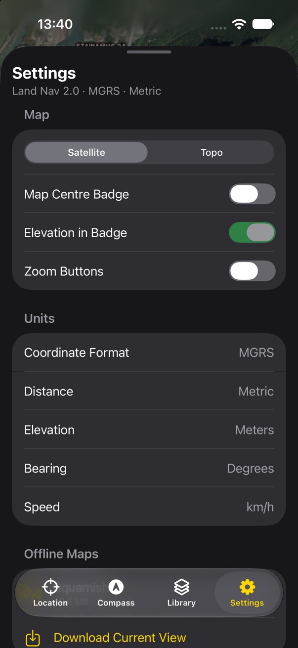
Settings rows open pages inside the panel, like a layer in the Library. Each choice shows what it does to a real number, so nobody has to know what DMS means:
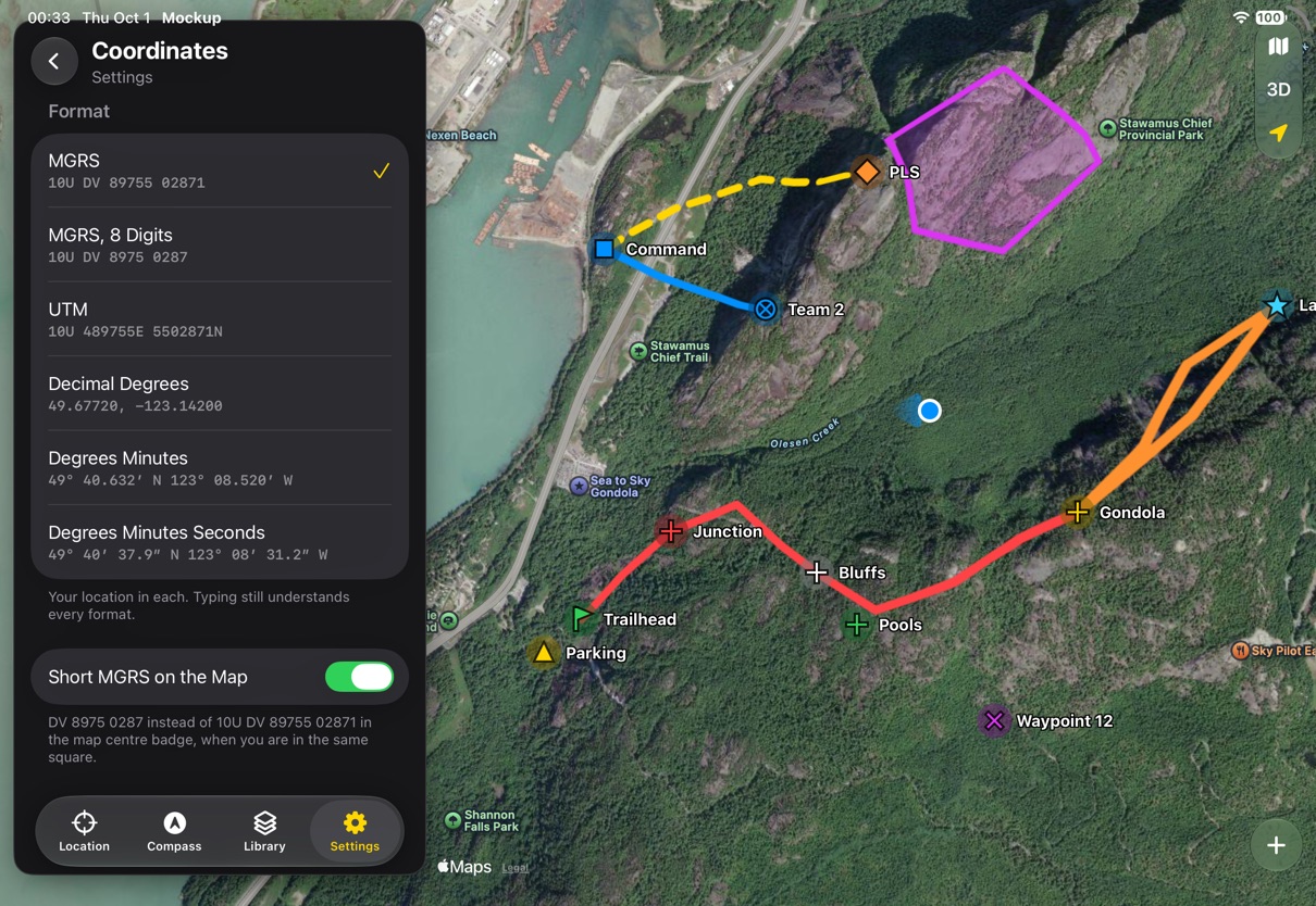
- Coordinates. Six presets, each showing your own location in that format, and short MGRS on the map. Typing still understands every format.
- Units. Metric, imperial or nautical in one tap, with each unit shown as one of your own numbers. Degrees or mils.
- Navigation. The arrival alert distance, true or magnetic bearings, declination from WMM 2025 or your own, and whether heading comes from the compass or GPS course.
Settings also gains Open In, for v1's preferred Maps and Weather apps.
- The presets replace v1's format editor. Are six enough? MGRS 6-digit and UTM with fewer digits are the likely asks.
Layers
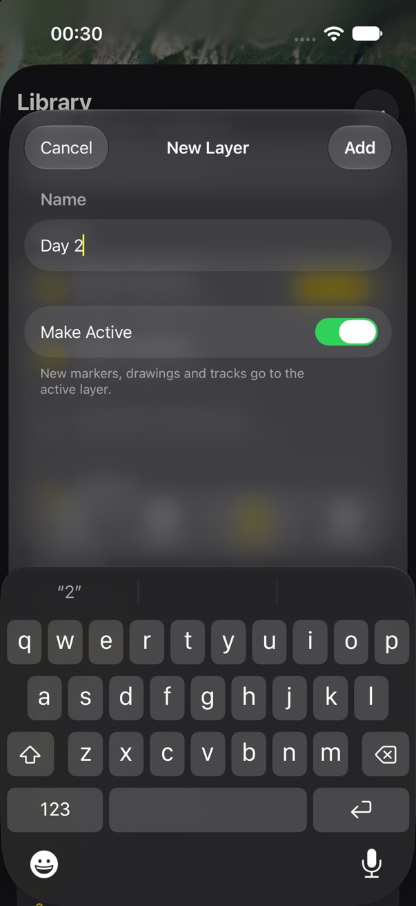
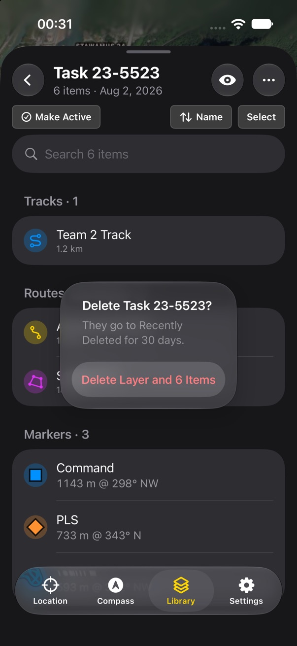
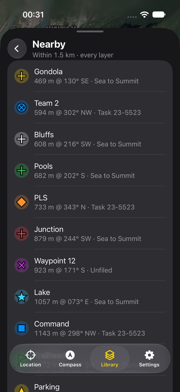
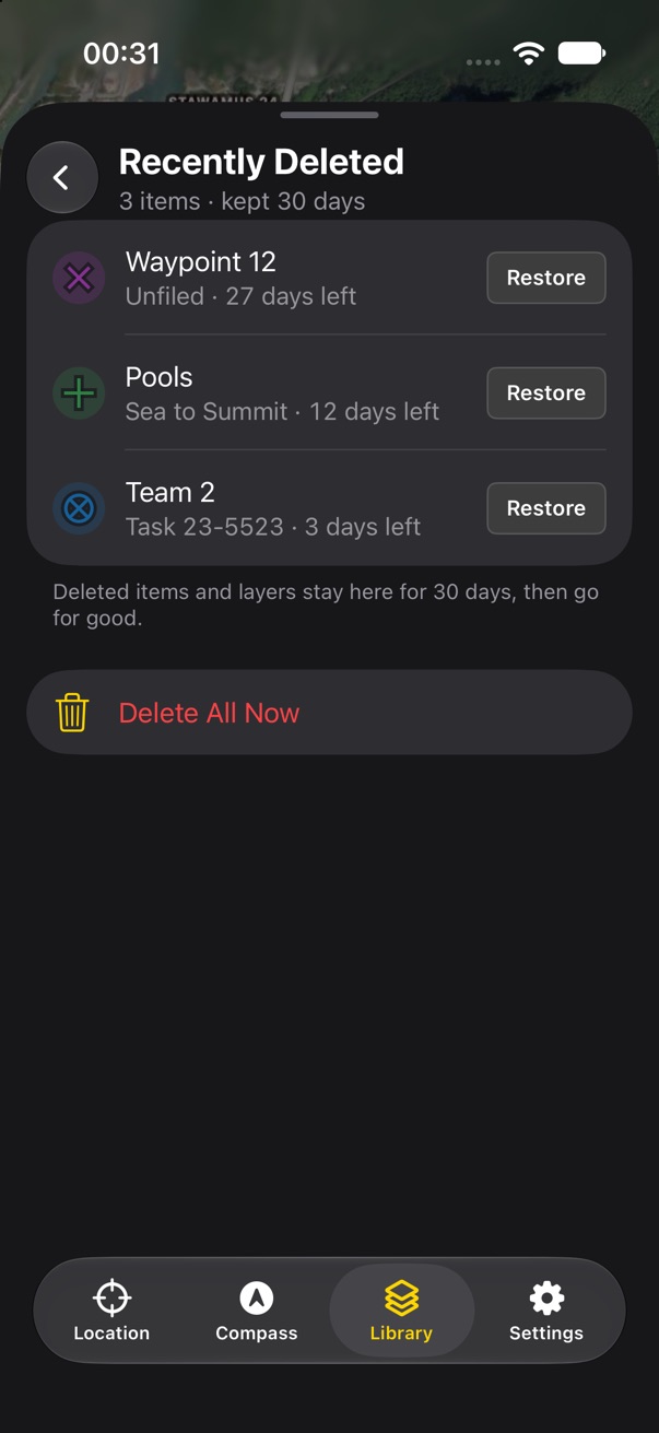
New Layer is a short sheet: a name, and Make Active, on by default, since you made it to put things in. Delete Layer asks first and says where things go: Recently Deleted, for 30 days. Recently Deleted is a smart list with the days left on each item and Restore on each row. Nearby is a smart list too: nearest first, from every layer, shown or hidden, with each row's layer named.
- Should deleting a layer keep its items in Unfiled instead, as an option in the confirmation?
Map controls
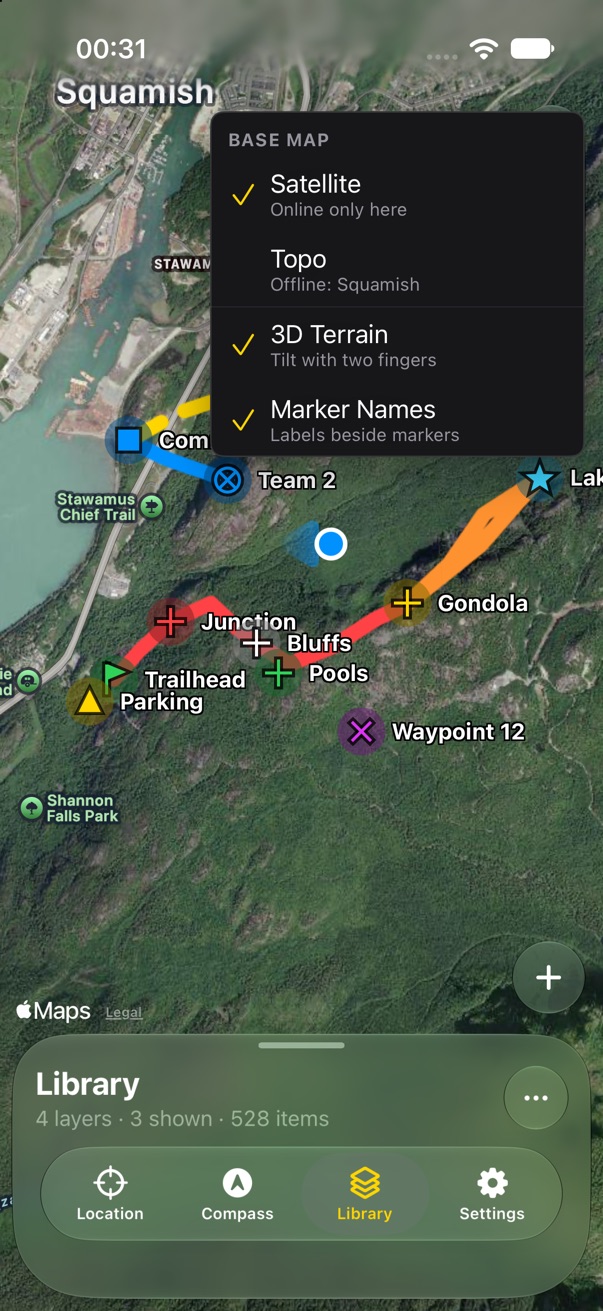
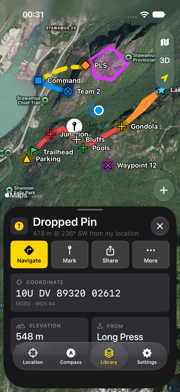
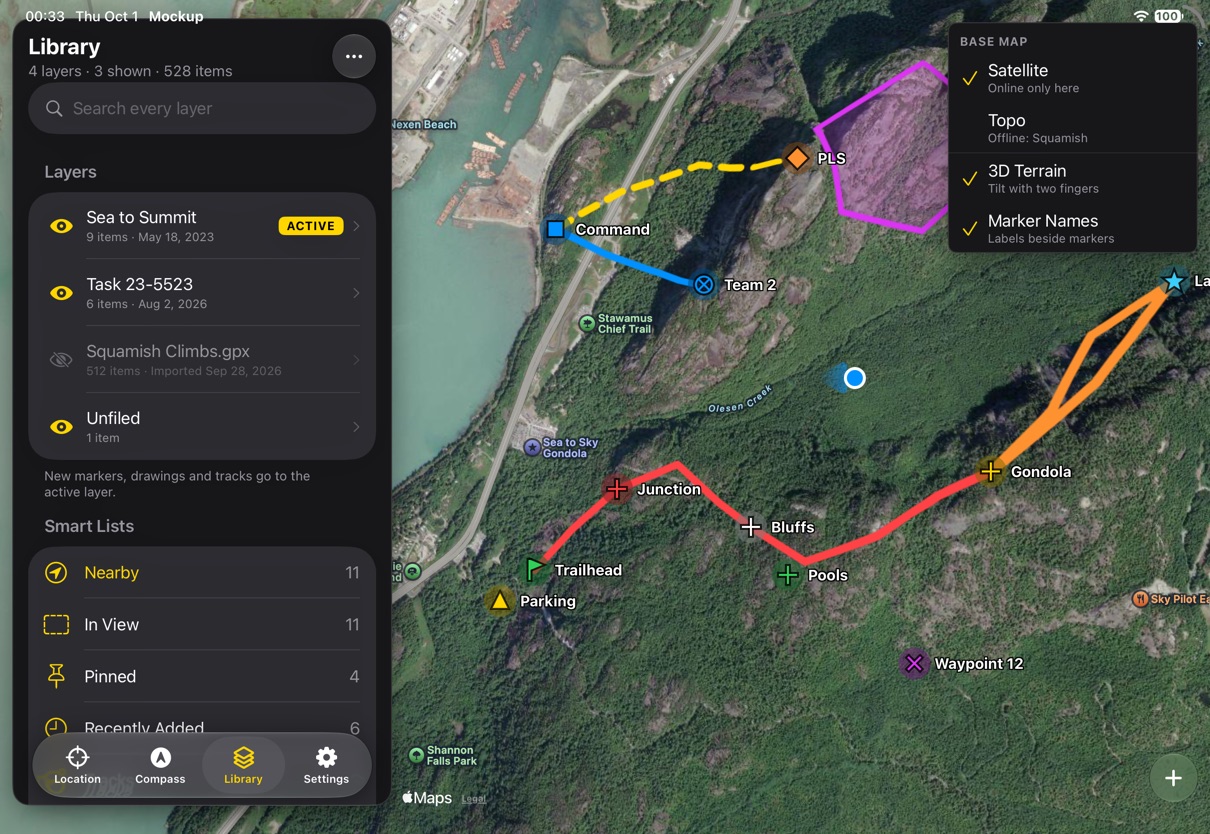
The map button opens a small menu: Satellite or Topo, each saying whether it is offline here, then 3D terrain and marker names. Zoom buttons, a setting, join the same capsule. A long press drops a pin with the item panel, as a search result does, with Long Press as its source; tapping the map centre badge does the same at the crosshair.
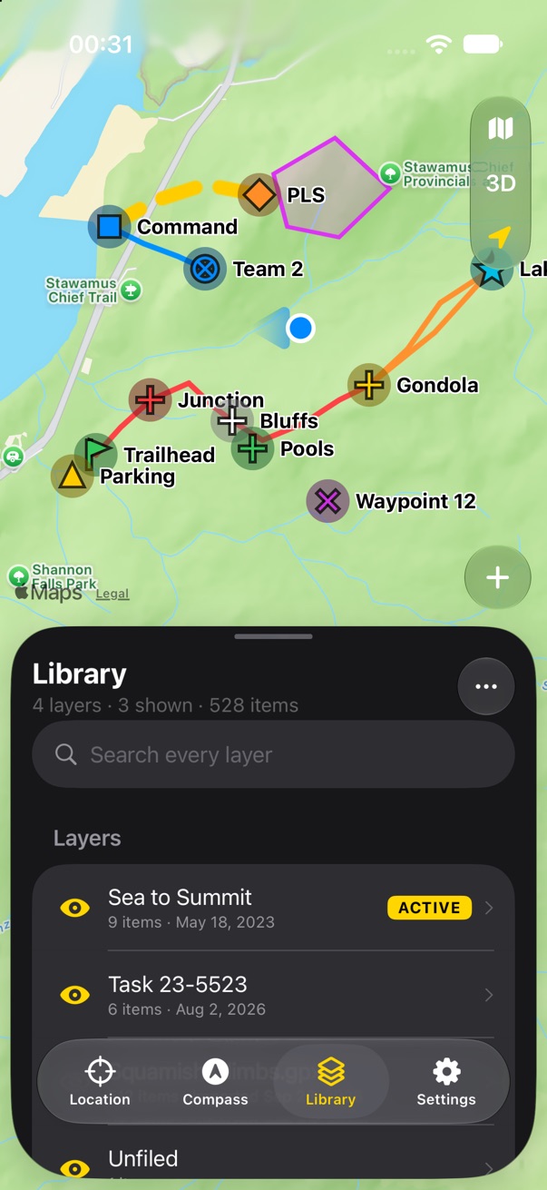
Topo is a light map under a dark app. It works: the panel and badges are solid enough to read on it, and labels switch to black with a white halo.
- Keep Topo light, or ask Mapbox for a dark outdoors style? Light reads better in sun, which is when topo gets used.
Land Nav 2 • Send Feedback • Land Nav 1 • © 2026 Gerry Shaw