Features
Offline maps, the ruler, tracks, search, the purchase, first launch, sun and moon, and Live Activities.
The eight features the shell left out, designed on the same system. Each one says what it is, what changes from Land Nav 1, and the calls still to make. Nothing here is built yet. Tap any picture to see it big. The everyday parts are on Details.
- Offline maps
- Ruler
- Track recorder
- Search and Go to Coordinate
- Support Land Nav
- First launch and migration
- Sun and Moon
- Live Activities
Offline maps
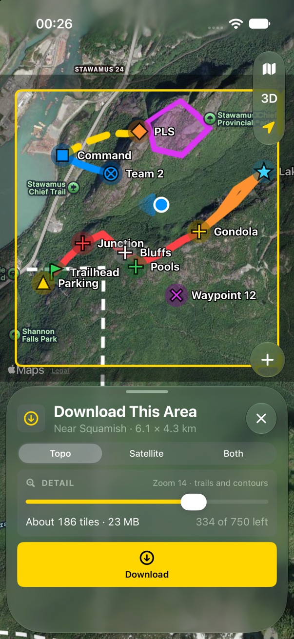
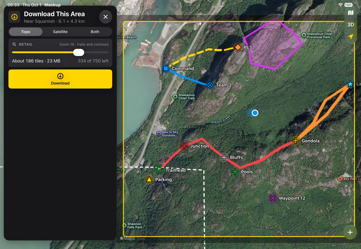
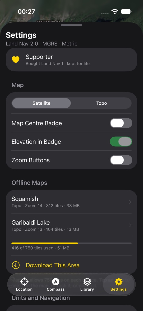
Download This Area, from the plus. The map is the picker: a yellow frame sits over it, the rest dims, and you pan and zoom until the frame holds what you need. Areas you already have show as dashed outlines. The panel shrinks to the choices: Topo, Satellite or both, how much detail, and what it will cost before you commit. v1 never said how big a download would be until it was running.
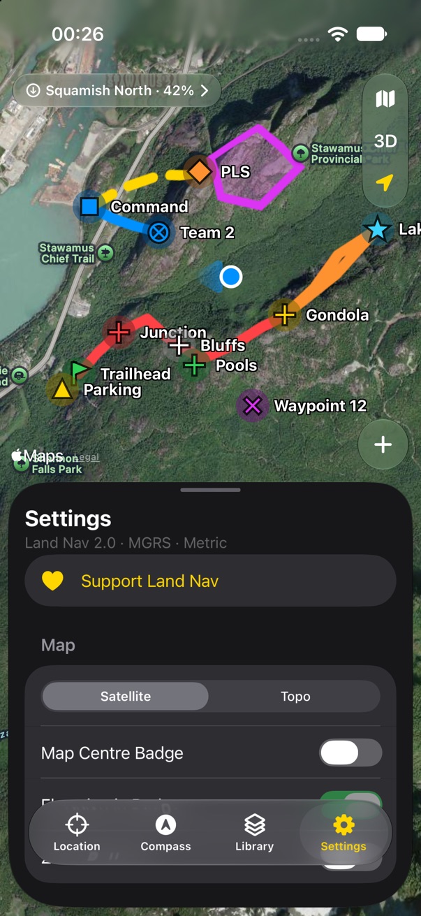
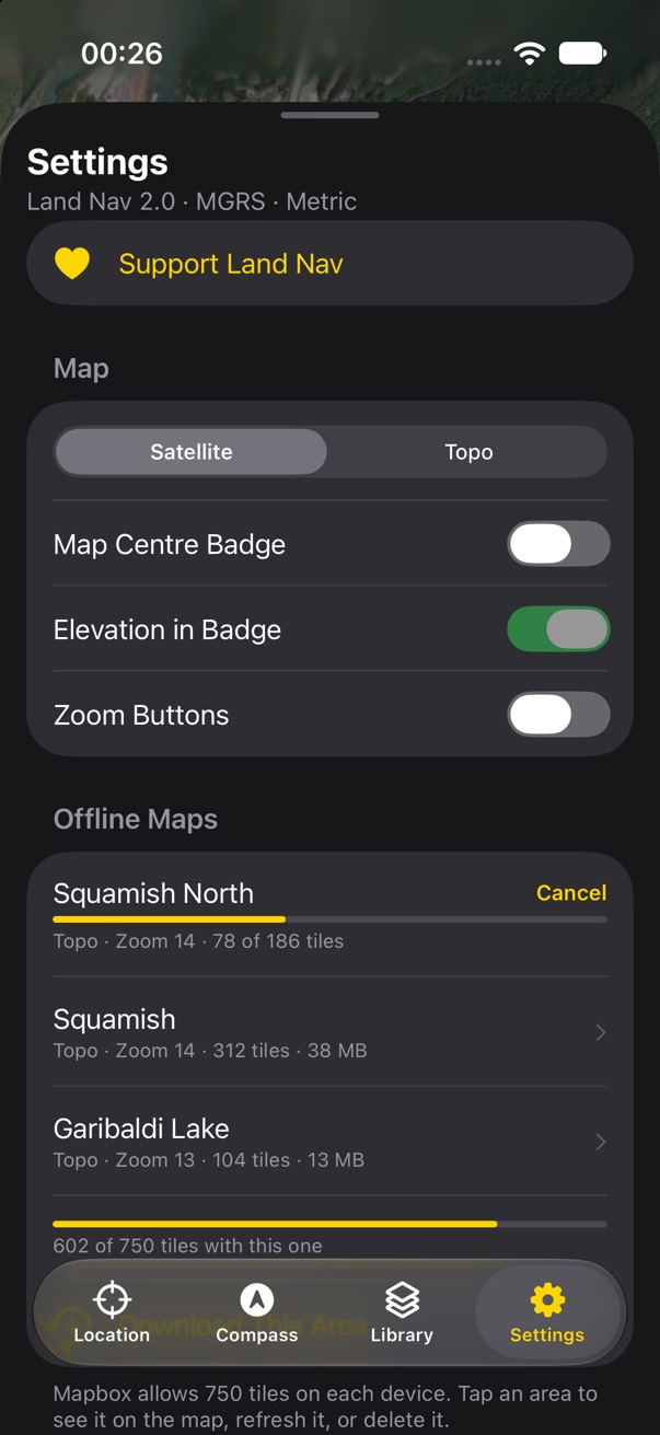
Mapbox allows 750 tiles on each device. The cost line counts against that budget, and Settings shows it as a bar under the list of areas. A running download is a quiet badge on the map and a progress row in Settings, so you can keep using the app. The name comes from the place, as in v1; rename it later in Settings.
- Satellite offline is new. It counts the same tiles but takes several times the room. Offer it, or stay topo-only as v1 did?
- Check the 750-tile cap still holds on Mapbox 11's TileStore before the cost line is built around it.
- v1 offers zoom 9 to 16. The slider keeps that range and names the levels ("trails and contours") instead of showing a number alone.
Ruler
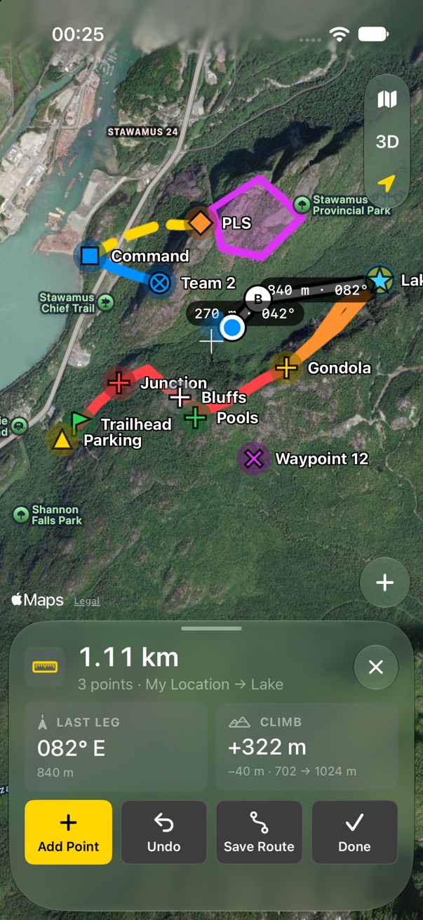
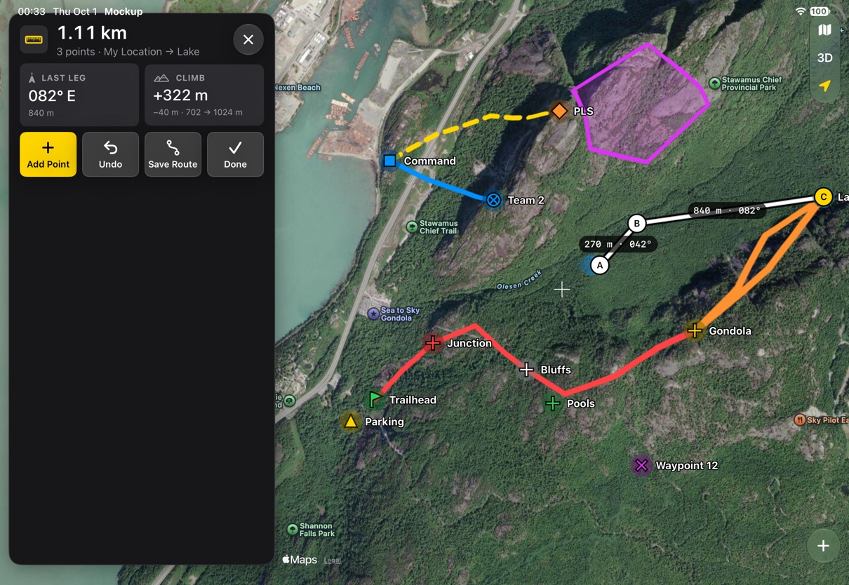
Measure, from the plus. It works like drawing: it takes over the panel, hides the tab row, and keeps the map big. Tap the map or Add Point at the crosshair; each point still snaps to your location and to markers, with the haptic tick, as in v1. The total is the panel's title. The two cells are the last leg's bearing and length, and the climb, because points pick up their elevation.
v1's ruler had two points, A and B. This one takes as many as you tap, so measuring a path no longer means drawing a route. Nothing is saved unless you tap Save Route, which turns the measurement into a route on the active layer. Each leg is labelled on the map with its length and bearing.
- Keep v1's draggable A and B as the start (two points already placed), or start empty and tap?
- Closing the shape could show an area, which would make Measure and Area drawing nearly the same tool. Merge them later?
Track recorder
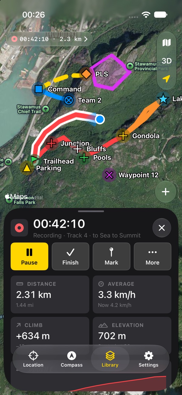
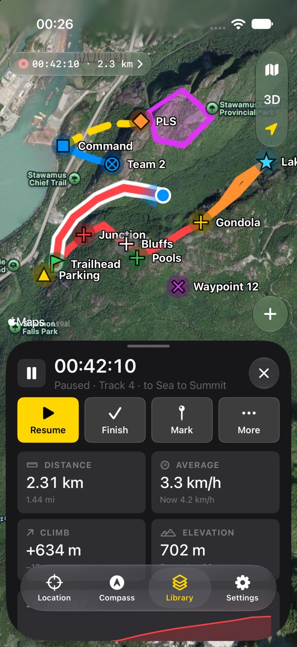
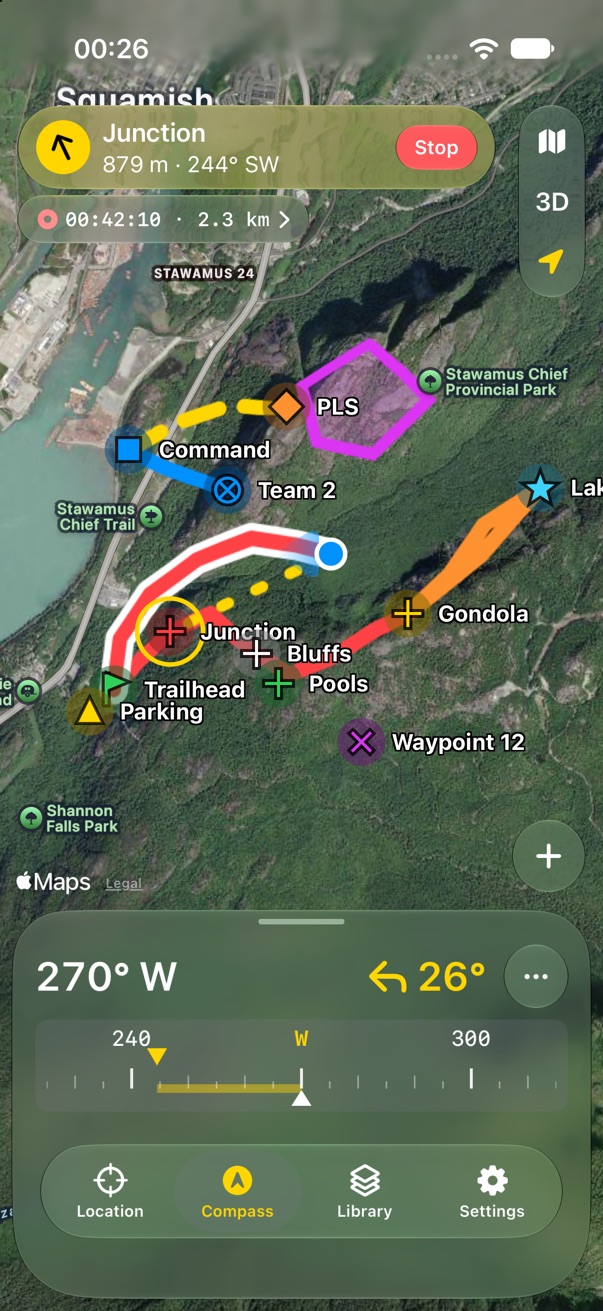
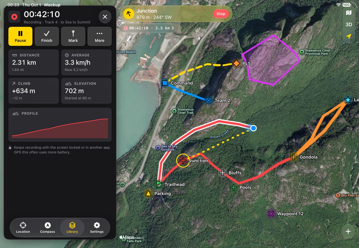
Record Track, from the plus. Recording runs in the background while you do anything else, including navigating, so it is not a mode. Its panel opens over the current tab, like a selected item: the elapsed time is the title, then Pause, Finish, Mark and More, then distance, average speed, climb, elevation and a profile. Close it and the recording carries on; the badge on the map brings it back.
The track draws in red with a white edge, so it stands out from saved red tracks. Finish saves it to the active layer. Discard is in More, with a confirmation. If iOS stops the app, recording resumes on the next launch, as v1 planned. v1 built this but never shipped it, so nothing here can regress.
- Pause is new; v1 had Start and Stop only. Keep it?
- Auto-pause when you stop moving? It saves battery and makes average speed honest, but surprises people.
Search and Go to Coordinate
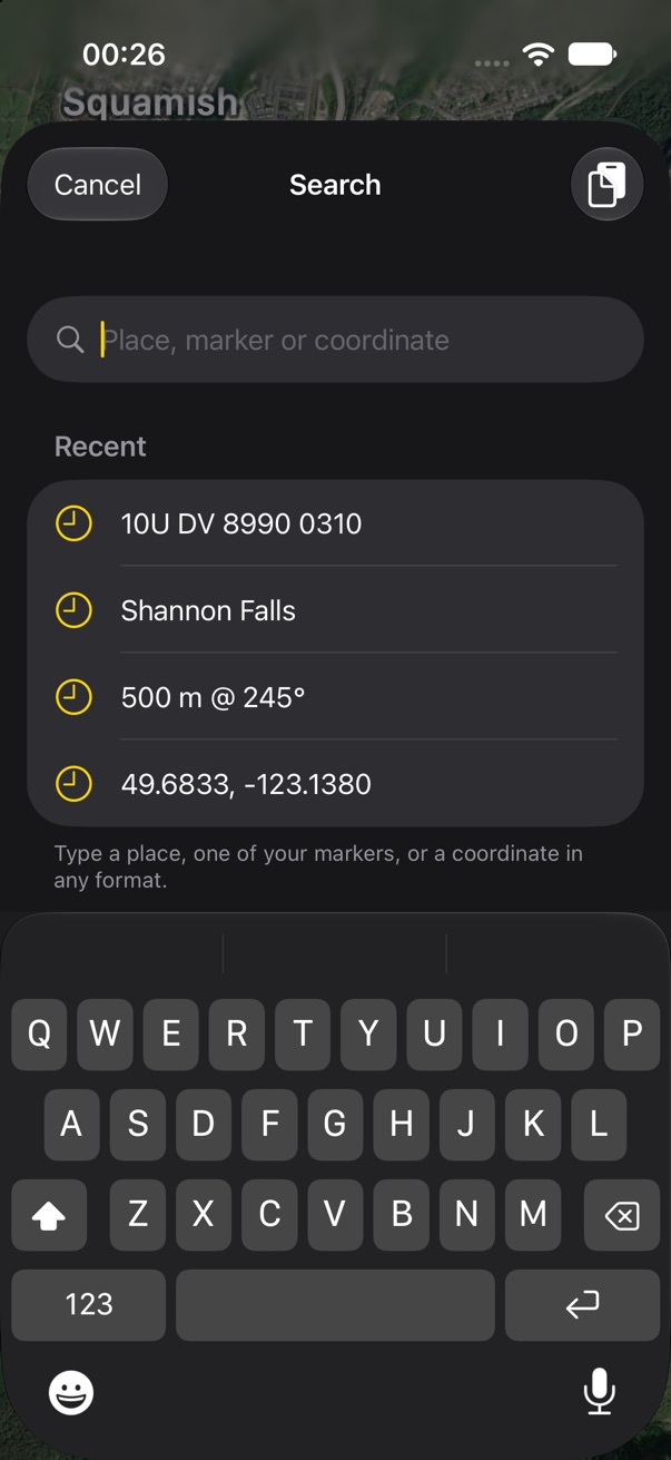
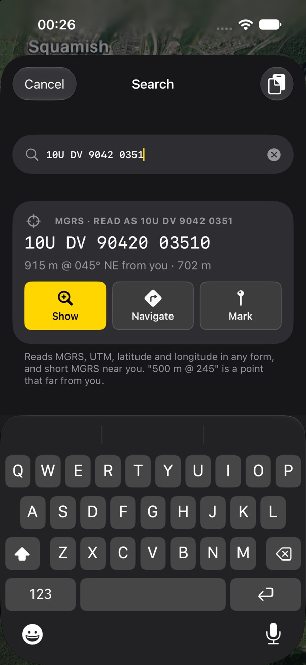
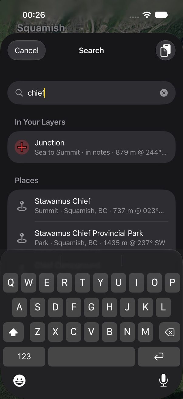
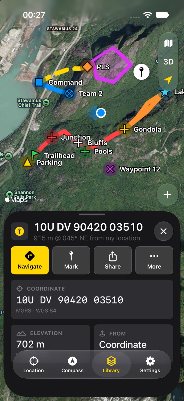
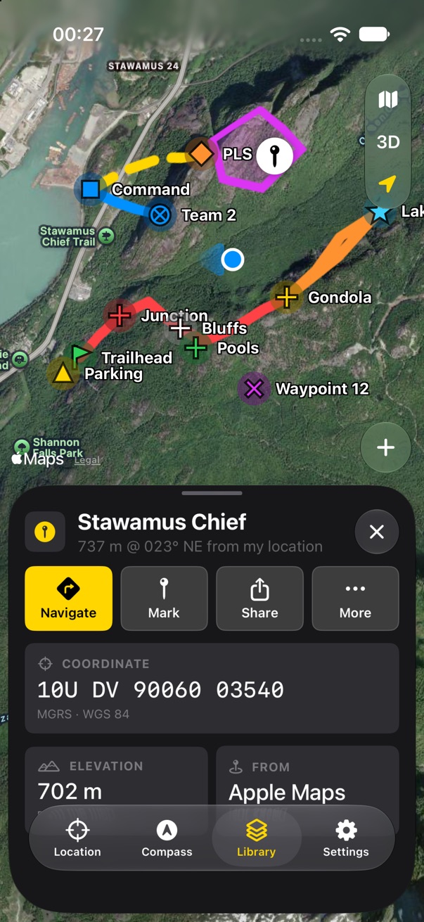
One sheet, one field. It reads what you type: a coordinate in any format v1 understood (MGRS, short MGRS near you, UTM, decimal degrees, degrees and minutes, DMS), a distance and bearing from you ("500 m @ 245"), your own markers, or a place. A coordinate gets one big card that shows what it was read as, how far it is, and Show, Navigate and Mark. Names list your markers first, then places. Go to Coordinate, Marker at Coordinate and Search in the plus menu all open it.
A result lands on the map as a pin with the item panel, with Mark in place of Edit, since it isn't saved anywhere. v1 kept search and Go to Coordinate as separate sheets and never checked search text for coordinates.
- Places: MapKit search (free, no key) or OpenRouteService (v1, better trail data, a key to keep secret). The plan recommends MapKit.
- v1's "Show Example Coordinates" is gone; the footer lists the formats instead. Enough?
Support Land Nav
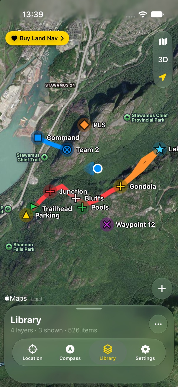
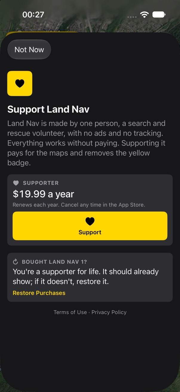
$20 a year, nothing locked. The Buy badge becomes "Support Land Nav": the same loud yellow, the same place, and it opens a sheet that asks rather than sells. It says who makes the app, what paying changes (the badge goes), and that Land Nav 1 buyers are supporters for life with nothing to do. Settings has the same button at the top, which becomes a quiet Supporter row once paid.
In the app the sheet is StoreKit's SubscriptionStoreView with this text as its header, so Apple draws the price,
the renewal terms and Restore. If a subscription lapses, the badge comes back. Nothing else changes.
- When does the badge first show? Proposed: after two weeks of use, so a new person's first look is clean.
- "Support Land Nav" or "Buy Land Nav"? Support is truer, since nothing is locked.
First launch and migration
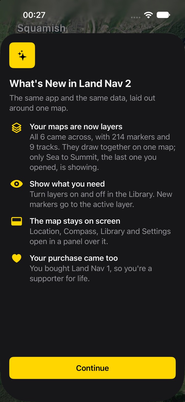
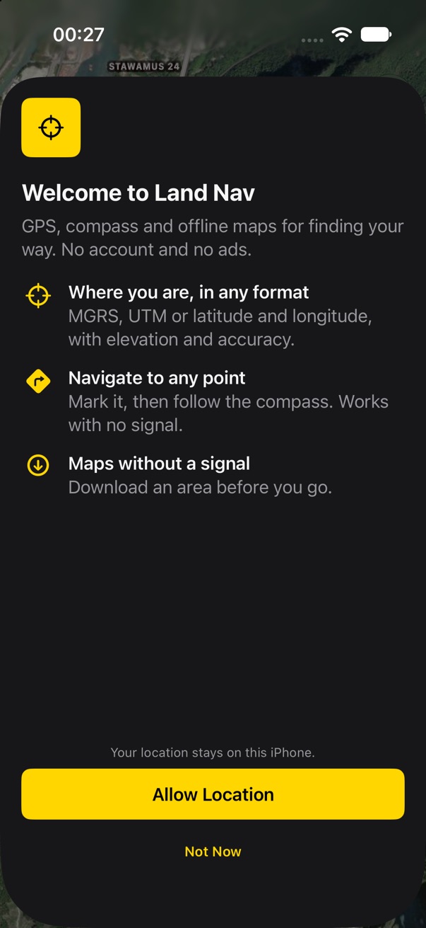
One sheet, one button, then the map. People coming from 1.x are told what moved: their maps are now layers on one map, how many came across, and that only the one they last opened is showing. If they bought Land Nav 1, it says the purchase came too. New people get three lines about what Land Nav does and the reason for location before the system prompt, with Not Now beside it.
Nothing else is asked up front. Notifications wait for the first arrival alert, as in v1. Migration itself has no screen: the data is the same Core Data store, so it is done before the sheet shows.
- iPhone on 2.0 and iPad still on 1.x share one CloudKit store. 2.0 must not write anything 1.x chokes on until both update.
- A sample layer for new people (a few markers near them), or an empty map?
Sun and Moon
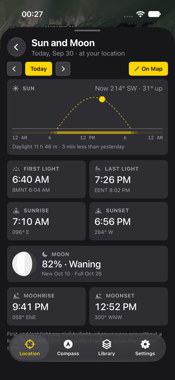
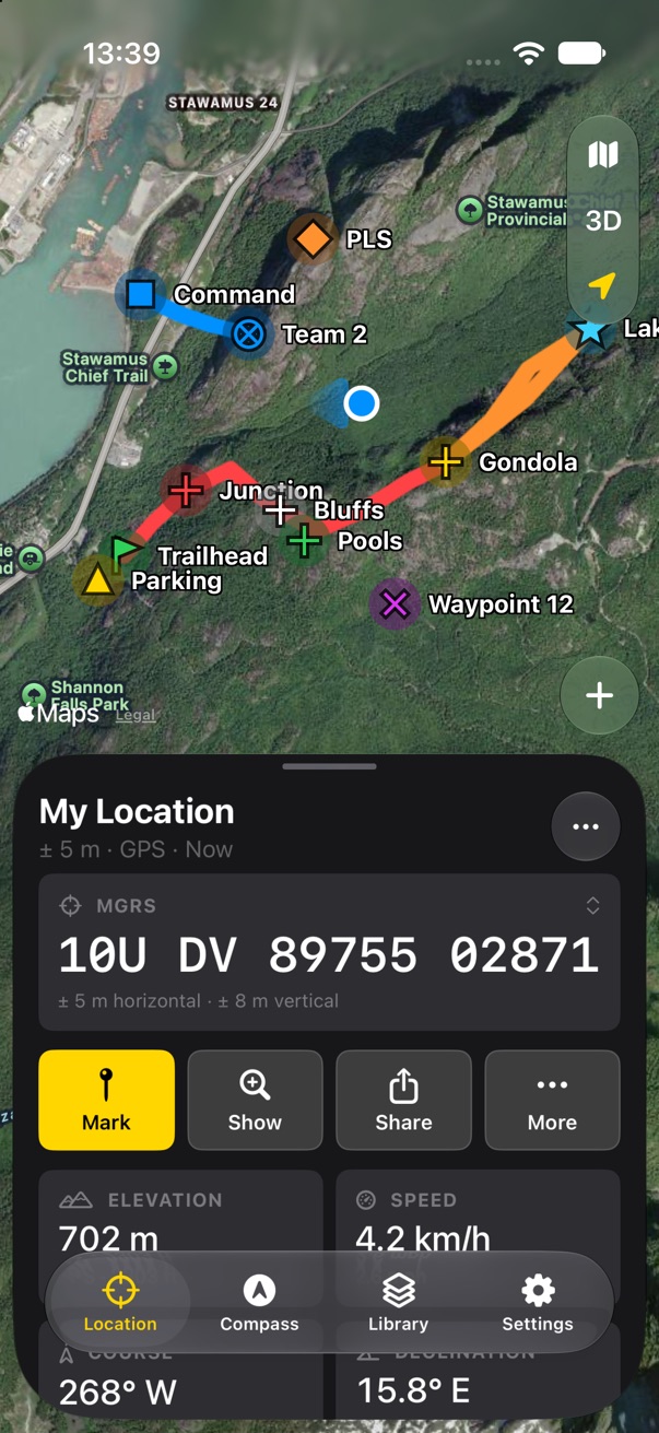
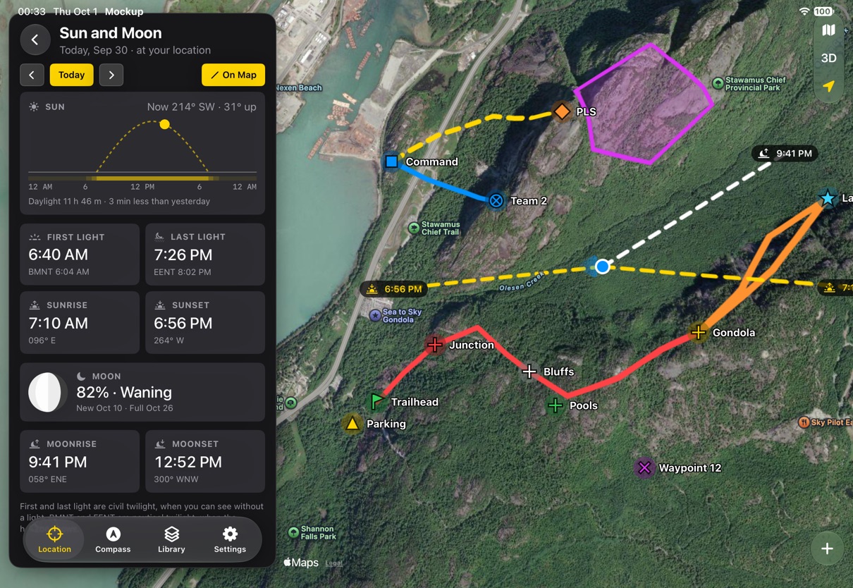
Tap the Sun or Moon cell on the Location tab, and Sun and Moon opens inside the tab, the way a layer opens in the Library. v1 showed sunrise, sunset and the moon's phase. This adds what matters for planning a day outside:
- First and last light, which is civil twilight, with nautical twilight as BMNT and EENT, the military's terms.
- Where the sun and moon rise and set, as bearings.
- Moonrise and moonset, and the next new and full moon.
- The day as one line: night, twilight and day as bands, the sun's path, and where it is now.
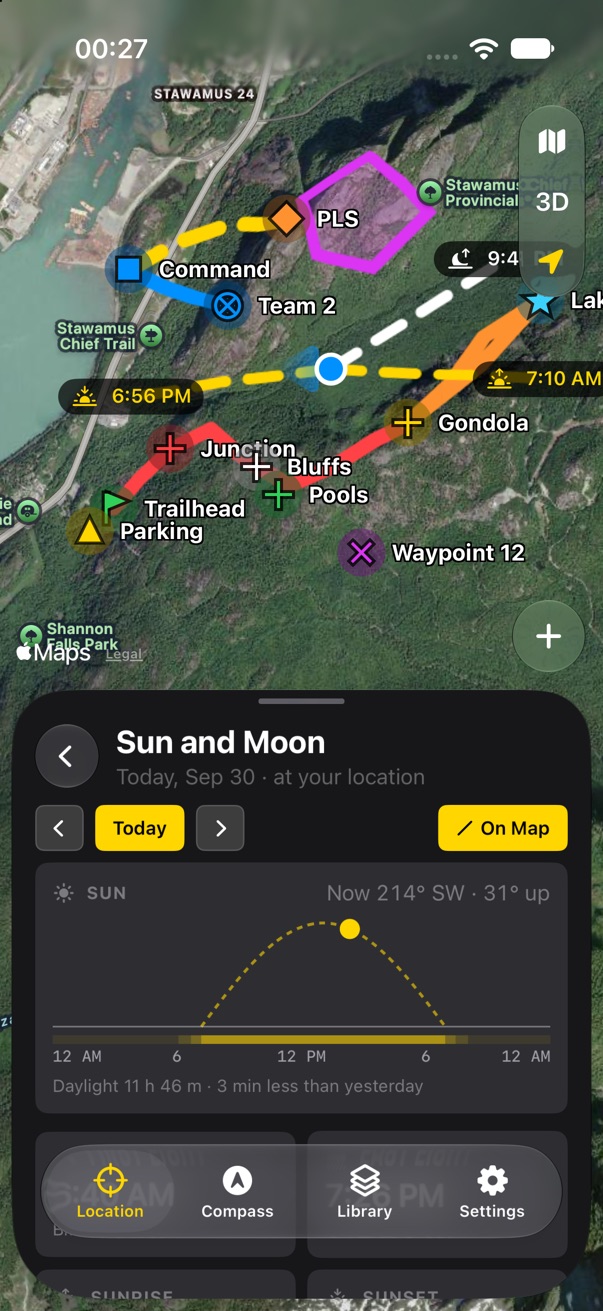
On Map draws those bearings from you, so you can see which ridge the sun will drop behind. The arrows step a day at a time.
- Use SunCalc as v1 does, or WeatherKit's sun and moon events? SunCalc works offline; WeatherKit doesn't.
Live Activities
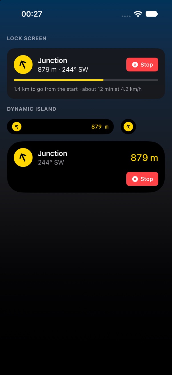
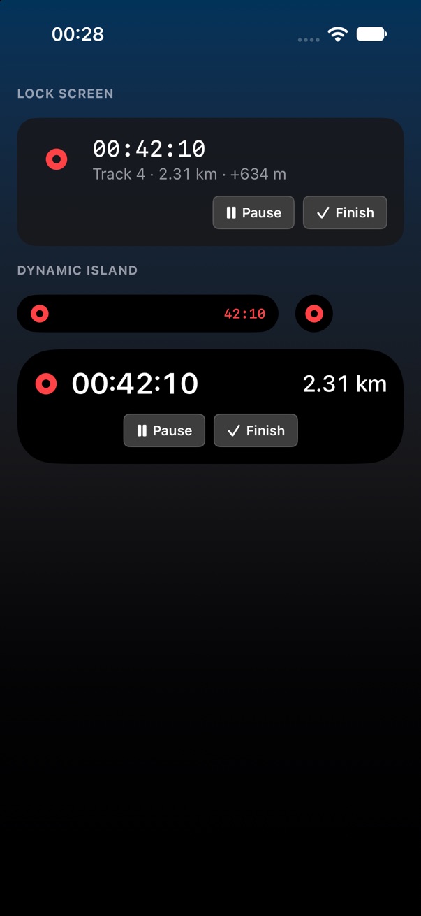
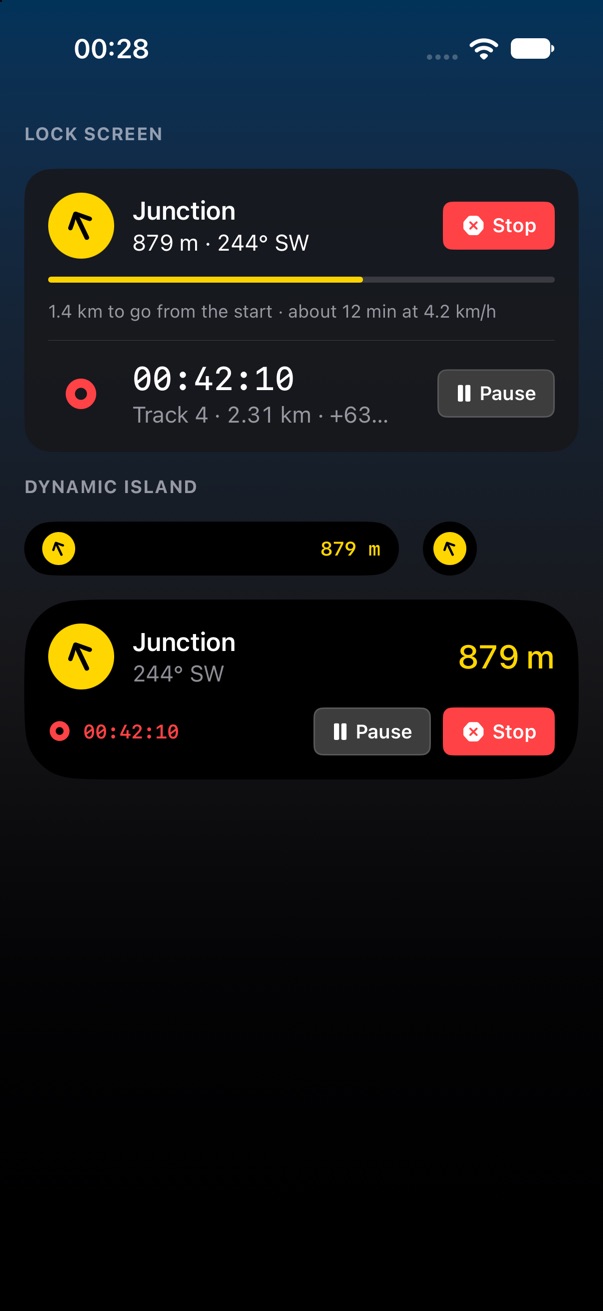
One Live Activity at a time: navigating, recording, or both in one card. Navigating shows the target, distance and bearing, how far you have come, and Stop. Recording shows the elapsed time, distance and climb, with Pause and Finish. The buttons are App Intents, so they work without unlocking. In the Dynamic Island the compact view is the arrow and the distance, or the record dot and the time.
The arrow turns against your direction of travel from GPS, not the compass, because the compass is not live while the phone is locked. It says so in the app the first time. The same activity shows on Apple Watch in the Smart Stack and in CarPlay, for free.
- Arriving: should the activity change when you are inside the arrival distance, as v1's banner did, or end with the arrival alert?
- These are drawn by hand: the mockup has no widget extension. Real ones need a check on the lock screen in sunlight.
Land Nav 2 • Send Feedback • Land Nav 1 • © 2026 Gerry Shaw